Summary
Would you be open to an interactive extruded GeoJSON map as a ThreeUI Community component?
The proposed component would render GeoJSON Polygon and MultiPolygon features as an interactive Three.js scene, with configurable extrusion, data columns, hover feedback, glow, camera behavior, and colors.
This proposal is informed by an existing working project, but I am not proposing to merge or embed the entire application into ThreeUI.
Existing reference:
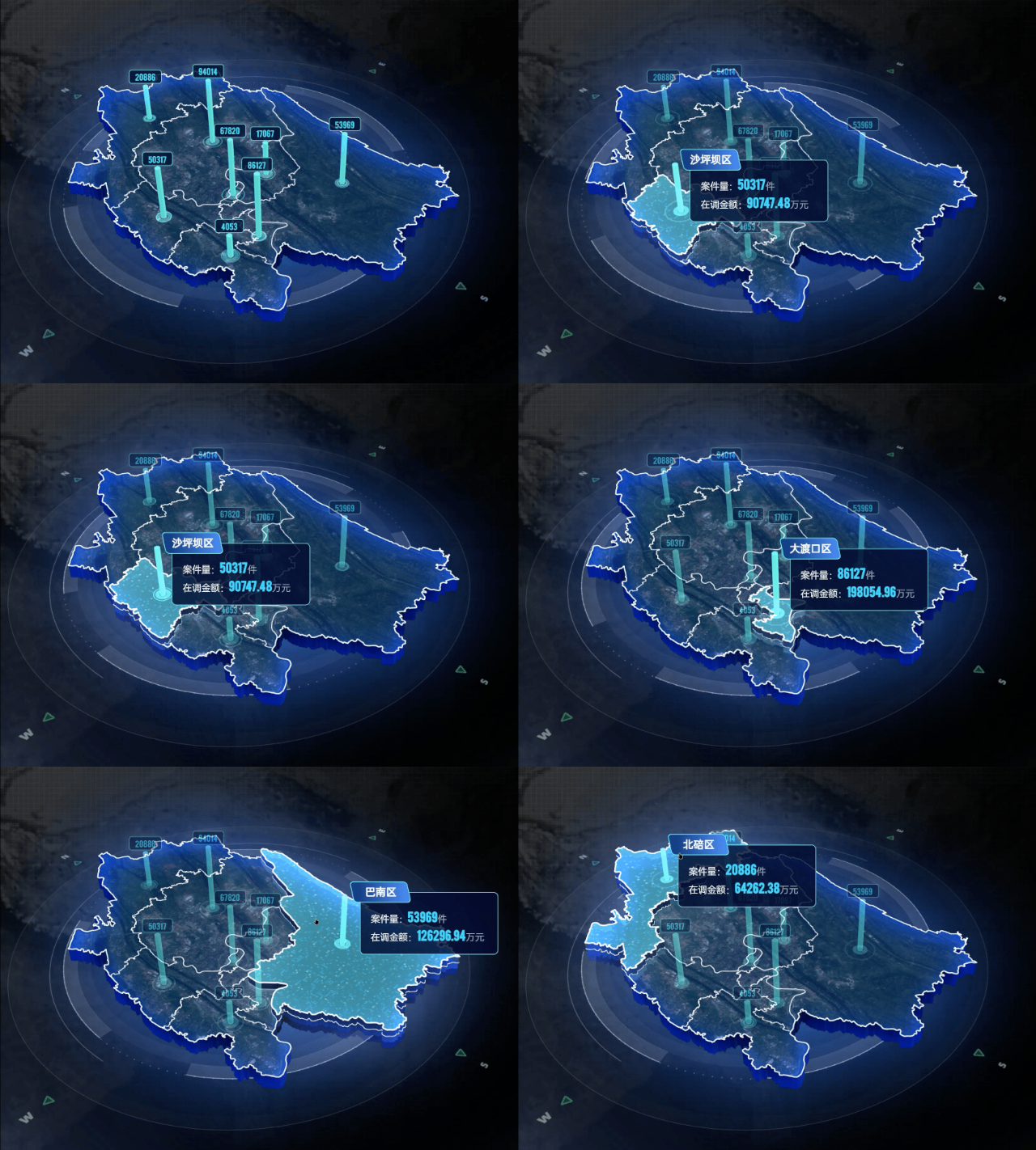
Proposed Community component
Working name: ExtrudedGeoJsonMap
The component would accept GeoJSON and optional regional metrics through props rather than including an authoring application or upload workflow.
Possible API direction:
geojson: a GeoJSON FeatureCollectionvalues: optional values keyed by feature identifierextrusionDepth and elevationScaletopColor, sideColor, and glowColorshowDataBarsautoRotateenableHover- camera and interaction options
Possible variants:
- Neon Regions — extruded regions with cyan edge glow and hover elevation.
- Data Bars — regional values represented as animated vertical columns.
- Wireframe Atlas — a restrained monochrome/wireframe treatment suitable for hero sections and technical dashboards.
Implementation boundaries
I would extract only the reusable renderer and adapt it to ThreeUI conventions:
- A framework-independent TypeScript/Three.js renderer.
- A small React lifecycle wrapper compatible with the public ThreeUI package.
- One WebGL context with complete resource cleanup.
- Responsive sizing through
ResizeObserver.
- Visibility-aware animation and document visibility handling.
- Reduced-motion support.
- No runtime network requests.
- No Vue, router, ECharts, IndexedDB, authoring panels, regional catalog, or upload workflow.
- No third-party fonts, satellite imagery, administrative datasets, or inherited dashboard assets.
- A small synthetic GeoJSON fixture for the default preview.
- Only code and assets that can be contributed under the repository's MIT license.
Why it may fit ThreeUI
The reusable part is a visual Three.js component rather than a domain-specific map application. It could work as an interactive hero, dashboard background, or lightweight geographic data visualization while keeping the consumer-facing API focused and customizable.
Contribution-path questions
Before implementing the extraction, I would appreciate guidance on:
- Does ThreeUI currently accept third-party Community component proposals?
- Since the public Community repository is synchronized from a separate main project, should a component contribution target this public repository, or should the source first be reviewed for inclusion in the main catalog?
- Would you prefer a small standalone React proof of concept before the package export, catalog metadata, controls, and variants are implemented?
I am happy to keep the first version narrowly scoped and follow the repository's preferred component structure and review process.
Summary
Would you be open to an interactive extruded GeoJSON map as a ThreeUI Community component?
The proposed component would render GeoJSON
PolygonandMultiPolygonfeatures as an interactive Three.js scene, with configurable extrusion, data columns, hover feedback, glow, camera behavior, and colors.This proposal is informed by an existing working project, but I am not proposing to merge or embed the entire application into ThreeUI.
Existing reference:
Proposed Community component
Working name:
ExtrudedGeoJsonMapThe component would accept GeoJSON and optional regional metrics through props rather than including an authoring application or upload workflow.
Possible API direction:
geojson: a GeoJSONFeatureCollectionvalues: optional values keyed by feature identifierextrusionDepthandelevationScaletopColor,sideColor, andglowColorshowDataBarsautoRotateenableHoverPossible variants:
Implementation boundaries
I would extract only the reusable renderer and adapt it to ThreeUI conventions:
ResizeObserver.Why it may fit ThreeUI
The reusable part is a visual Three.js component rather than a domain-specific map application. It could work as an interactive hero, dashboard background, or lightweight geographic data visualization while keeping the consumer-facing API focused and customizable.
Contribution-path questions
Before implementing the extraction, I would appreciate guidance on:
I am happy to keep the first version narrowly scoped and follow the repository's preferred component structure and review process.